Wednesday, July 26, 2006
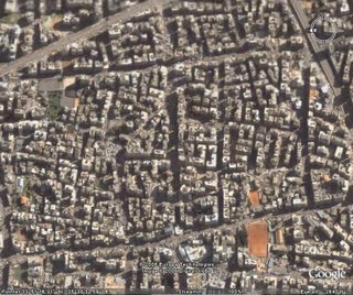
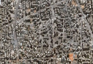
Sattelite image of Hezbollah district in southern Beirut
| Before | After |
 |  |
DigitalGlobe released a picture of a southern Beirut after the Israeli bombings. According to Stratfor this picture shows the Bir al Abid district of downtown Beirut, Lebanon, a known Hezbollah stronghold. The second picture was taken by Google Earth (before the bombing). Notice that buildings from neighbour districts remained unharmed.
Update 29-july-2006: Those of you that installed Google Earth can have both pictures overlayed one on top of the other.
technorati tags: googleearth google earth lebanon war middle east beirut